
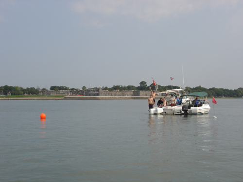
LAMP research vessels anchored off the Castillo de San Marcos on St. Augustine’s waterfront to investigate a ballast pile in the harbor as part of the 2010 Field School.
Things have been so busy around here lately because of our field season, I’ve been neglecting our blog! Here is the second installment regarding our 2010 Field School, which brought 9 new students and 4 returning students to our nation’s oldest port to learn the basic techniques of maritime archaeology. In our first installment, I overviewed the training the students underwent before going into the field, and the initial stages of fieldwork on an offshore shipwreck. But mechanical troubles with the research vessel Roper led to a change in plans. For a week we switched from working offshore to a newly discovered site, possibly a shipwreck, in Matanzas Bay along St. Augustine’s historic waterfront. Here are two of our secondary research vessels, RV Desmond Valdes and RV Nickerin, anchored over the approximate location of the Bayfront Ballast Pile off the 17th century fort Castillo de San Marcos.
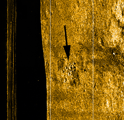
Sonar image of the bay floor, with an arrow pointing out the pile of stones comprising the Bayfront Ballast Pile site.
The Bayfront Ballast Pile was discovered in 2008 by our friends and colleagues at SEARCH, Inc., when they were conducting a sonar and magnetometer survey for the City of St. Augustine. The City is establishing a series of boat moorings on its bottomlands in Matanzas Bay, and because of this survey and the discovery of this possible shipwreck, the mooring installation activities will safely avoid this potentially historic site. Above is the original sonar image of the bay floor, with an arrow pointing to the ballast pile, courtesy of SEARCH and the City of St. Augustine.
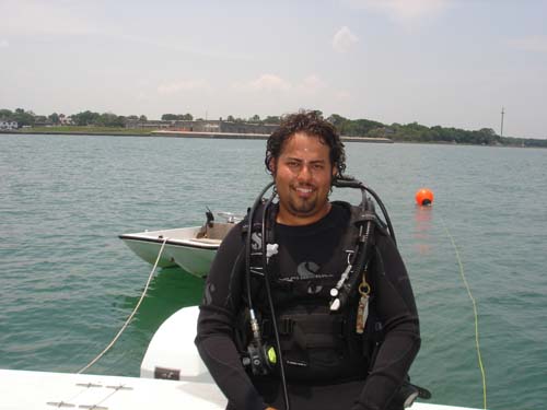
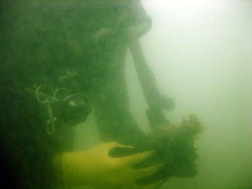
SEARCH divers confirmed that their sonar image did indeed portray a pile and scatter of stones on the seafloor, which would have originally been ballast on board a sailing vessel. A few artifacts were found amid the stones as well, though there is a great scatter of historic artifacts on the floor of the bay, as it has served our port for almost 450 years. The site represents either the wreck of a sailing vessel, or the spot where a sailing vessel dumped a considerable amount of its ballast in order to take on a heavy cargo. Our goal is to dive on the site, map its extent and exposed features, and document any diagnostic (identifiable) artifacts, in order to determine which scenario took place here, and better understand the condition and cultural history of the site. Here Field School student Justin Twidt of North Carolina State prepares to dive on the site. In the background is the recently renovated Bridge of Lions, part of the city’s maritime landscape since the 1920s.
Field School student Alex Vidal, a student at University of South Florida, poses in front of the Castillo before his dive.
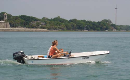
Our trusty 13′ Boston Whaler, the Indy, serves as a chase boat for the Bayfront Ballast Pile operation. This is a critical safety component as the tidal currents here are extremely strong. In fact, we stage our dives in the very brief period of slack tide that occurs at the peak of high tide, but by the end of the dive the waters begin to course back out to sea, making for extreme currents. Most of our divers can barely swim against that current at all on the surface, so the Indy is needed to assist or retrieve divers when necessary. Field School Supervisor Kaia Brown, who has just started graduate studies at Cranfield University in the United Kingdom, is captaining the Indy. Kaia is a returning student from last year’s field school.
The strong tidal currents do have one great advantage for us, and that is visibility. The bottom of the bay is sand, because the muddy sediments that are prevalent in most bays is scoured away twice each day by the ripping current. At the lowest extent of low tide, the currents are also slack, but the muddy river water that flows out to sea makes vis almost zero, so the only time to effectively dive is the narrow window at the height of high tide. In this photo, a diver inspects a broken ceramic sherd. Visibility this good (5 to 8 feet perhaps) is rarely seen offshore, so we intend to make the most of it when mapping this site and its scattered artifacts.
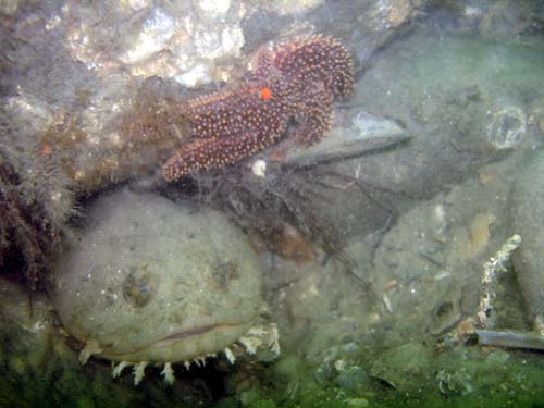
We are not the only ones enjoying the great visibility on this site. Here is a toadfish and a starfish hiding among the ballast stones, watching these strange two-legged, bubble-spewing visitors.
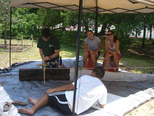
The students are also exposed to a variety of other archaeological activities during our hiatus away from the offshore excavation. Since we can only dive in narrow tidal windows on the Bayfront Ballast Pile, we don’t need all of our divers on the water at once, so during this week we rotate groups of students to stay back at the Lighthouse to learn how to record shipwreck timbers. Here Devin O’Meara, of Grand Valley State University, and Pat McGovern of Plymouth State University record the dimensions and construction features of the Blowhole Wreck keel, while Supervisors Wendy Drennon (graduated from Florida State University, and accepted for graduate studies at Flinders University in Australia) and Megan Staley (graduated from Kansas State University, and now a LAMP Intern Archaeologist) look on. Wendy and Megan are Field School Supervisors and returning students from last year’s field school. The Blowhole Wreck is a beached shipwreck from nearby Anastasia State Park. A northeaster storm exposed its wreckage and broke its keel free, which was recovered in May 2008 by LAMP archaeologists and interns.
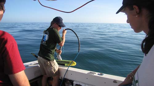
The students also participate in remote sensing survey activities. Here LAMP archaeologist Brendan Burke prepares to lower the fish into the water, as Field School student Katie Kelly of University of Indianapolis looks on.
Then, on the 21st of June, with one week left in Field School, we finally get word that the Roper’s engine has been fully repaired. The students, and staff, have been itching to get back on that site, as it may turn out to be an early colonial vessel and we were all ready to commence digging when boat troubles began. As we have finished a preliminary map of the Bayfront Ballast Pile, we are ready and eager to get back offshore to the Storm Wreck.
Stay tuned to Part III of our 2010 Field School blog to read about the conclusion of our students’ research experiences here in the nation’s oldest port.
Click here to read Part I of the 2010 Field School blog posting
Coming soon! Part III