LAMP staff and volunteers documented a beached shipwreck on 2 January 2014, our first shipwreck project of the new year!
On New Year’s Day LAMP got a call from First Coast News reporter Jessica Clark. She had been contacted by a local Ponte Vedra Beach resident, Sharon Caruso, about a shipwreck exposed on the beach.
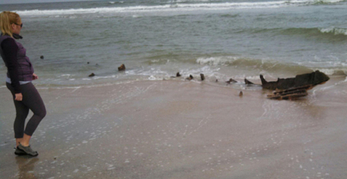
A significant patch of wreckage was exposed in the surf which had been previously buried in the sand. At low tide the outline of a ship could be seen pretty clearly. First Coast News ran a story on the wreck that day:
PONTE VEDRA BEACH, Fla. — Carol Caruso likes to walk on Ponte Vedra Beach, but she hadn’t been out in a few weeks. When she walked along the shore Tuesday, she saw something big.
With her hands held out wide, she said, “This is what I found at low tide!”
It appears to be the skeleton of a ship, right where the waves hit the beach.
“I’ve been looking at it for two years,” Caruso explained but she’s never seen so much of it coming out of the sand.
“Generally it’s just that point, literally that point sticking up and that’s it. So I thought this had to be something special,” she beamed.
The ribs of the ship appear to be jutting out from the beach above the waves.
. . . Archaeologists with the Lighthouse Archaeological Maritime Program (or L.A.M.P.) in St. Augustine have been out to the site before, studying it. However, after seeing pictures of the ship Wednesday, archaeologist Brenden Burke said he and the L.A.M.P. team have never seen so much of the ship exposed.
Burke explained that parts of the ship have been revealed three times in the last six years.
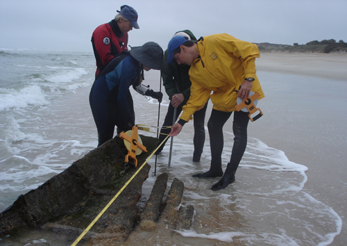
The very next day, LAMP sprung into action, and a group of archaeologists, students, and volunteers assembled on the beach at the start of low tide to document the newly exposed portions of the wreck.
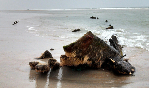
Looking at the wreck, facing north.
A quick inspection confirmed that much more of the wreckage was exposed this time around. Back in September and October of 2008, when LAMP first visited the wreck, the large section of iron plating was exposed, with some planking, along with five iron frames or ribs. This time more of the plating was exposed, with more planking, and a total of 42 iron ribs were visible!
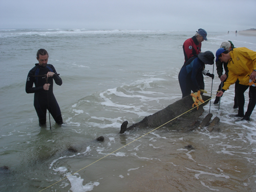
We pounded two poles into the sand, at either end of the wreckage, and strung a tape measure between the two to serve as a baseline. This tight line went more or less along the centerline of the vessel, as best we could tell, at an angle of 8 degrees on the compass (roughly parallel to shore). The exposed wreckage spanned a distance of 22.83 meters, or just about 75 feet. We know there is more wreckage buried to the north, so the original ship would have been longer than 75 feet.
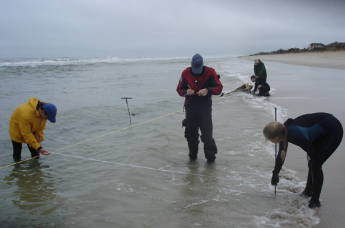
In addition to the prominent section of iron plating and wooden planking, which we think is probably the bow of the vessel, the 42 iron frames or ribs extend to the north in a curved line, defining part of the side of the vessel. We measure the position of each of these frames by taking offset measurements from the baseline. Thus, each frame can be plotted out on a site plan or drawing of the wreck, by measuring its position along the length of the baseline, and its distance out from the baseline.
Here is a brief video clip, showing the southern portion of the wreck with our recording crew. It gives you a good idea of what its like to work on a shallow wreck in the surf zone. At low tide, as seen here, it is workable, but it is still difficult to see what you are trying to draw in brief windows between waves.
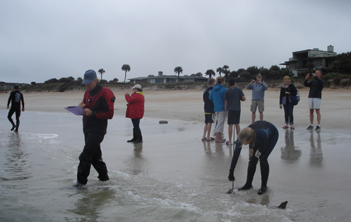
Quite a crowd gathered to watch as we worked, even though it was a rainy and blustery day! Some folks had seen the news story, but most had no idea there was a shipwreck here, and were surprised to hear that the Lighthouse maintained an archaeological research program.
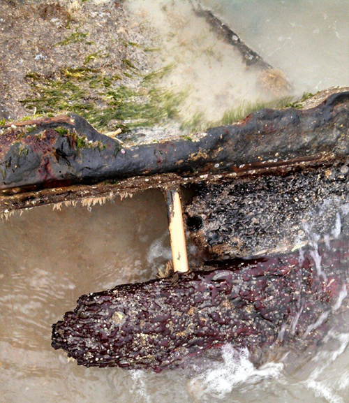
There are a lot of interesting construction features that we can make out, despite the waves which tend to obscure the wreck. In addition to the section of iron plating, and free-standing iron frame ends, there are wooden planks and other, more substantial timbers, pictured above. These are fastened with copper-alloy bolts (like the shiny one seen above). Known in the 19th century as “yellow metal,” the mix of copper and probably zinc and other metals were used in conjunction with sheathing of the same material, which kept shipworms from eating the wood of the hull. This ship displays what was known as composite construction, or both iron and wooden ship members. Composite construction came about as a phase between traditional wooden ship construction and iron shipbuilding. Typically, a composite hull used iron frames on the interior and wooden planking on the exterior. It first became widespread in Britain in the 1860s, and dominated British shipbuilding for the next decade or so until supplanted by iron ship construction. While iron hulls replaced composite hulls relatively quickly in Britain, which was the epicenter of the Industrial Revolution, composite construction continued later in other shipbuilding countries. The composite construction of this hull suggests that it was built sometime between the 1860s and the early 20th century. The iron plating, with wood on its outboard surface, is somewhat unexpected, however. Iron plating was not usually used on composite hulls, and wooden timbers or planking were not usually placed on the outside of iron plating. So we still have somewhat of a mystery on our hands . . .
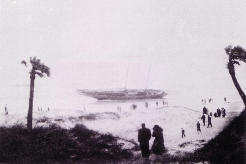
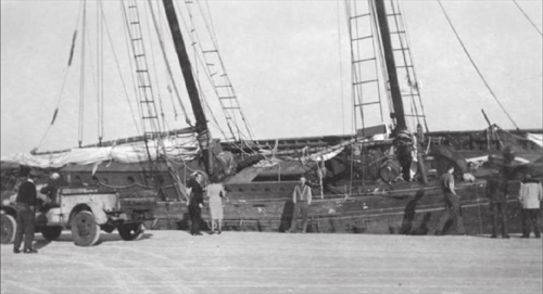
We have a number of possible candidates for this shipwreck. From our shipwreck database we have compiled a list of ten wrecks lost at Ponte Vedra between 1866 and 1974. The most likely candidate is a schooner that was run ashore by a nor’easter in the fall of 1947. This wreck came to our attention from a local history book by Karen Harvey, which featured a photograph of the wreck.
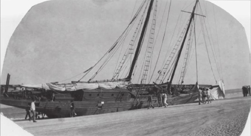
Just today, we also found another history book, by Maggie FitzRoy, with more pictures of the schooner. This source indicated the schooner was lost in December of 1947. Neither book gives any indication of the name of the vessel, however.
Back in 2008, when we first found this shipwreck, we had followed up with research focused on the photograph of the 1947 schooner. While we could not find the original source of the photograph in Harvey’s 1980 book St. Augustine and St. Johns County: A Pictorial History, we tried to find references to it in the local newspaper. To do so we contacted the National Weather Service to track down all tropical storms or nor’easters that occurred in the fall of 1947. We then used those dates to look up issues of the St. Augustine Record. While we found stories on the storms, we never came across any reference to a beached schooner. While this wreck has been off our radar for a while, the next logical step is to search the archives of the Jacksonville paper, the Florida Times-Union.
In the meanwhile, we have gotten some more good press from our brief investigation of this shipwreck. Within an hour after our visit to the wreck, the New York Daily News came out with a story:
There’s a mystery lying within the sand of a historic Florida beach that has left local archeologists and residents scratching their heads.
A massive shipwreck has been unearthed by St. Augustine’s tides, where European settlers and Spanish explorers, searching for the legendary Fountain of Youth, once sailed.
The ship’s bony hull — estimated at being a little more than 80 feet long — unveiled itself in Ponte Vedra Beach Tuesday after years of sitting nearly completely covered.
The Lighthouse Archaeological Maritime Program (LAMP), now studying the weathered vessel, believes they are getting closer to solving its origin — though it’s much newer than first suspected.
“We don’t know specifically what ship it is yet,” Public Relations Coordinator Shannon O’Neil, who was out studying the ship on Thursday, told the Daily News.
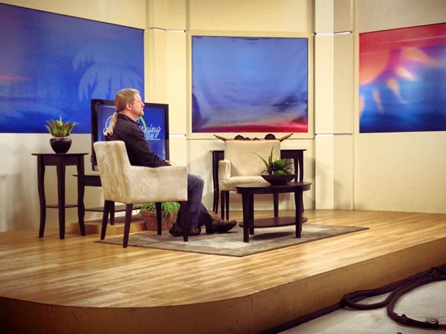
In addition, First Coast News wants to do a live on-air interview with me tomorrow morning. That’s great for spreading the news about the significance of our region’s maritime history, but not so great for me, since I’ll have to wake up early on a Saturday to get to Jacksonville for the 8:45 interview! All in a day’s work for a maritime archaeologist in our nation’s oldest port!
UPDATE: Here’s a photo of me waiting to go on the air live for my interview on the Good Morning Jacksonville news show! Believe it or not, I clean up pretty nice . . . !