
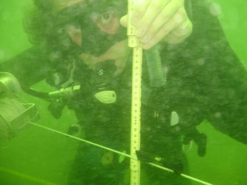
LAMP Field School student Chris Borlas takes advantage of good visibility to use a line level and folding rule to measure the depth of an excavation unit underwater. For the past three weeks, it has been so dark and murky on the wreck site that trying to see an air gauge, compass reading, tape measure, hand signal, or line level has been completely fruitless.
On the first day of diving this this week, LAMP staff and students alike were ecstatic to find that, with no warning, they could suddenly see on the shipwreck site. Visibility had been slowly improving over the past several weeks, so that divers could begin to see to a limited degree the site around them, instead of relying on groping in the dark. But all of the sudden the vis was great! We wasted no time and took advantage of these conditions while we had them.
We’ve posted some underwater video from Tuesday so everyone following along can experience seeing the shipwreck as we do. Check it out below!
In this video clip, you can see several divers working on the site at once. The video pans along our trench, so that you can see our grid system that we use to keep track of where we are digging and what we are drawing. Remember, for most of the past three weeks we felt blindly along these lines, and felt but never saw our grids! It is easy to make out ballast stones, though many have been removed from the trench, and also exposed timbers from the hull buried beneath the ballast. The droning noise audible during some of this clip is the Air Line hookah–a low pressure gasoline-powered compressor on the surface feeding air down the yellow hoses to the divers. The divers still wear a tank on their back as a backup air source, but the hookah (unless it runs out of gas) can provide unlimited air for longer and safer dives. Towards the end of the clip, the camera pans out past the trench so the rest of the ballast pile is visible.
Here is another clip showing some great visibility, also from a morning dive. The divers are again working in the trench, and you can see them leveling a line in order to measure the depth of the excavation unit. The string is anchored at a rebar firmly in place at the top of a large concretion, and we measure depth in centimeters below that arbitrary point. Excavators record the level of the center and four corners of each unit before starting to dig downwards, and record their current level at the end of a dive to keep track of how much we have excavated. In addition, all sediments dredged are run through a fine mesh screen, and accurate vertical measurements help us keep track of any artifacts that might have been sucked up the dredge without the divers’ noticing.
Another short clip showing divers working in the gridded excavation trench. There are some good shots of the hull timbers here, including a substantial longitudinal timber we believe to be a stringer. Its great to see all of these fish too–we have no idea if they have been swirling around us every day for the past four weeks as its been to dark to see them!
The vis worsened by the end of the working day, however, as you can see here. This diver is mapping a unit, or making a detailed drawing of all exposed archaeological features within a one meter square area. The particulate matter in the water has dramatically increased, reducing visibility by a significant degree. It almost looks like the diver is making a drawing in a snowstorm!
As far as visibility goes when diving off our Nation’s oldest port . . . easy come, easy go.
And finally an above-water shot, of Wendy entering the water from the Roper‘s swim platform.
Stay tuned for more videos of divers working, coming soon!