
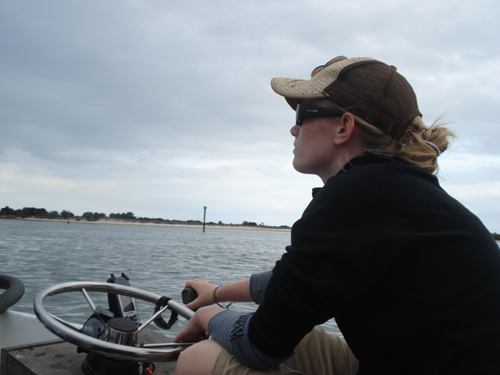
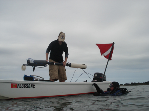
LAMP’s newest intern archaeologist, Lindsay Jones, skippers the Indy during today’s diving operation.
Finding shipwrecks is not easy. Finding them in Salt Run is particularly challenging. Today’s dive objectives were located within the main channel, which even on a February weekday afternoon saw pretty heavy recreational boat traffic. Then there was the 57 degree water, almost non-existent visibility, and of course the tidal currents . . .
Other than a brief respite during slack tide, our divers struggled against the increasingly strong current. Fighting a current in a drysuit and full gear is one thing, but while dragging an unwieldy hand-held magnetometer or an even more unwieldy 10′ long hydraulic probe spewing a powerful jet of water, it becomes a strenuous exercise of willpower and brute force.
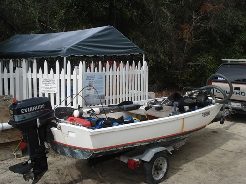
Our diving platform and runabout is the research vessel Indy. Her full name is Indefatigable, and she has certainly performed tirelessly and reliably during our Salt Run dives. In addition to two divers, the boat driver, and sets of scuba gear, the boat contains our recently purchased hand-held submersible magnetometer, and a water pump, firehose, and probe. Our mission is to seek out and dive on magnetic targets that were identified after analyzing the data collected during a magnetometer and side-scan sonar survey carried out last November (see “LAMP Surveys Salt Run”).
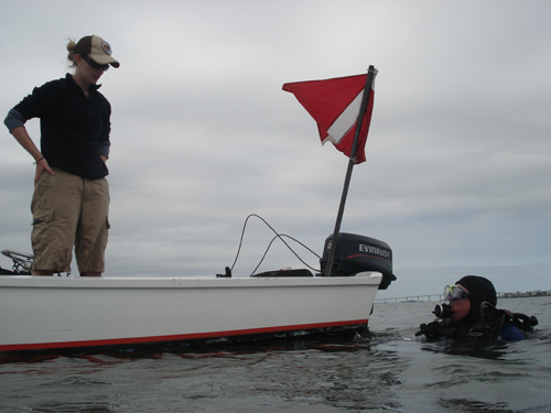
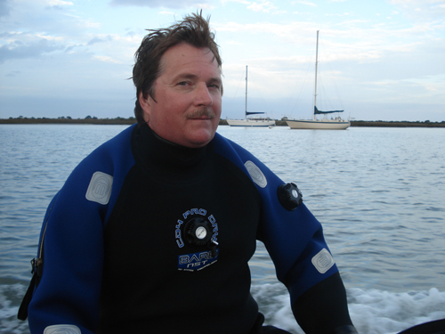
Lindsay, on the Indy, is our surface support team–serving as dive timekeeper, dredge manager, and coxswain. Volunteer diver John Carpenter assists as buddy to LAMP Director, Chuck Meide.
After analysis of data collected during the magnetometer and sonar survey, LAMP archaeologists came up with a list of over 20 targets which warranted further investigation. The objective is simply to locate each target, and identify each while assessing whether any of these might represent historically significant material, such as a shipwreck. Salt Run was historically a swash channel that at various times served as the primary entry channel for St. Augustine. Previous survey operations offshore identified a number of shipwrecks just off the historic mouth of Salt Run (which is now silted in); there is every possibility that the remains of a ship lost in the channel might survive buried beneath the thick, silty mud bottom of Salt Run.
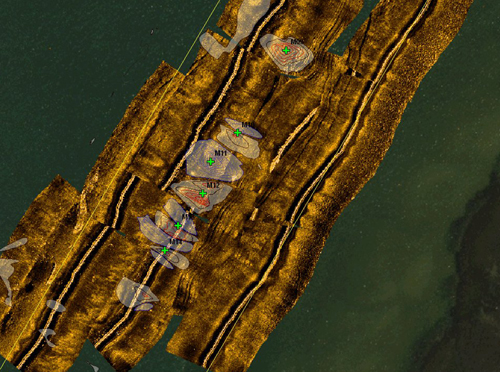
LAMP archaeologists use GIS or Geographical Information Systems to analyze remote sensing data. This view shows sonar imagery of the seafloor superimposed over 2005 aerial photograph of Salt Run. In addition, the magnetic anomalies are shown on this map (small crosses with labels) along with the magnetic contouring. This software allows us to manage this data, keep track of which targets we have tested and which ones need to be located by the dive team.
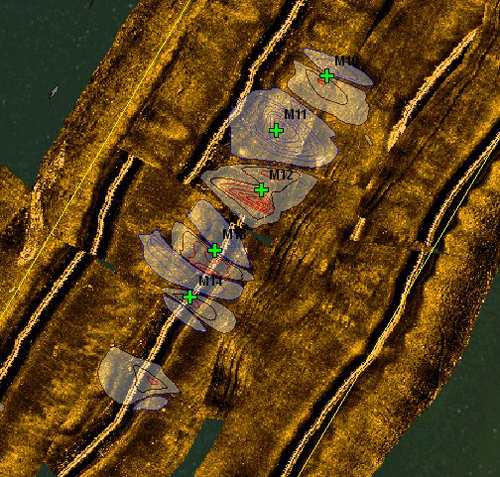
This is a closer view of the overlaid data. The magnetic contours indicate a linear string of anomalies. This could represent a pipeline or, because of its location in the center of the channel, it could represent debris dropped from modern recreational watercraft. The coordinates of specific targets, marked as green crosses, were determined by analyzing the magnetic contouring.
Today we are in a busy section of the channel which contains six magnetic targets in a row. We’ll be happy if we can successfully assess at least two of them, as we didn’t make it onto the water until after 11 am. The first step in this process is to mark the location of the magnetic anomaly with a buoy thrown at the coordinates indicated on a hand-held GPS. Then a dive team will use a hand-held magnetometer to pinpoint the exact spot of the strongest signal from the anomaly.
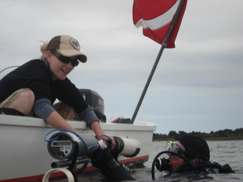
Lindsay carefully hands down the mag to John.
The hand-held magnetometer is totally waterproof and features a small LED display which provides a readout every 2.5 seconds of the earth’s magnetic field measured in gammas. The presence of either iron or steel buried in the bottom mud (or interference from an outboard engine) will cause a warping or anomaly in the earth’s magnetic field, which causes readings significantly higher or lower than that of the ambient.
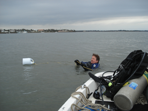
At this site the water is so shallow (around 7′ deep) the diver swims on the surface with the mag extended down towards the bottom. The boat backs away from the divers, so that its engine and steel won’t interfere with the mag (though Lindsay keeps a sharp eye out for oncoming boat traffic and will recall the divers if needed). Once a series of strong readings is displayed, the location of the anomaly is marked with a buoy. A dive team descends to the bottom, searching the area around the buoy for objects protruding up from the mud. They then probe by hand with 5′ steel rods.
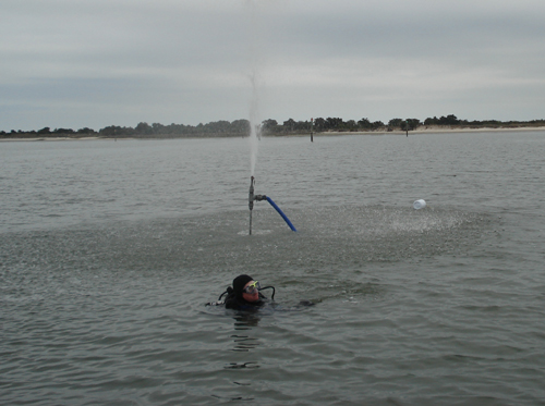
When nothing is found using these methods, we bring out the big guns . . . the hydraulic probe is basically a ten foot long section of pipe (two 5′ sections attached to each other, actually) connected by a fire hose to a gasoline-powered water pump on the Indy. With this we can determine if there are any large, solid objects buried up to ten feet beneath the mud. The hydraulic probe sends a powerful jet of water straight down, allowing the pipe to easily sink down into the mud. A counter-jet firing upwards from the probe can be turned on or off, and sometimes helps the divers steady the probe in the water column.
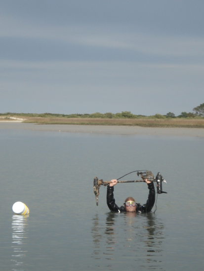
Sometimes we quickly find the object which had been detected by the magnetometer survey back in November. Here Chuck raises up a lost trawling motor which was previously known as M12, or Magnetic Anomaly 12. Even though its obviously of no historic importance, it is good to know that the equipment and methodology works. The exact identification of other targets remain elusive, however. Two other targets, M11 and M09, are dismissed without identifying their source, as extensive probing indicates that no large objects, such as ballast, cargo, or hull remains, exist.
Volunteer diver John Carpenter on the ride home. John is one of the newest members of our scientific diver team, and he is also a certified divemaster.
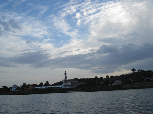
One of the great things about working at Salt Run is that we are always within sight of the Lighthouse. Not only is it a great view of the tower against a cloudy backdrop, but is reassuring to see that navigational landmark, which immediately places us on a mental map of the waterways.
Today we cleared three targets. Pretty good progress. We are hoping to finish up all of our targets by the end of next week. So far, we have found some great old treasures, including the trawling motor, a steel cable, a crab trap, and a small ca. 1980s portable television. If we find a historic shipwreck, lost during its navigation of St. Augustine’s entry channel sometime in the last 450 years, you’ll be the first to know.