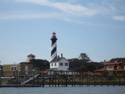
A major part of LAMP’s First Coast Maritime Archaeology Project is to survey bodies of water around St. Augustine, America’s oldest port, in an attempt to discover historic shipwrecks and other maritime archaeological sites. One area we had definitely planned on searching was Salt Run, the channel running alongside the Lighthouse and dividing Anastasia Island from Conch Island. At one time this served as the main navigational channel for St. Augustine, and it would have seen significant vessel traffic (and shipwrecks!). The Salt Run survey was re-prioritized once the Port Authority of St. Augustine announced that it was planning on dredging the channel and modifying the boat ramp dock. In order to prevent the possible destruction of unknown archaeological sites, an immediate survey of Salt Run was necessary.
This survey has a personal significance for us, as the area to be impacted by construction of the new dock is immediately adjacent to the site of the original Lighthouse (built in the 1730s) and a series of Spanish watchtowers before that. Not only is this in our backyard, but as the caretakers of the current tower we also feel a responsibility to be good stewards of the archaeological remains of its earlier incarnations. As such, we devised a comprehensive plan that would be most likely to detect even the smallest trace of these remains which might be in the impact zone.
Typical marine surveys involve the use of a magnetometer to detect iron material, and a side scan sonar to produce images of the seafloor. In this case, we were concerned these standard devices might overlook buried, subtle, and non-ferrous features, such as the Lighthouse keeper’s trash pits, which might possibly still exist under the mud in Salt Run. Because of this, we added two additional methodologies to our search–the excavation of a series of test pits across the dock/boat ramp area, and the use of a sub-bottom profiler to search beneath the sediments.
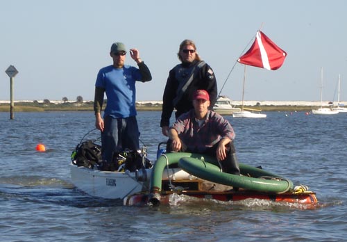
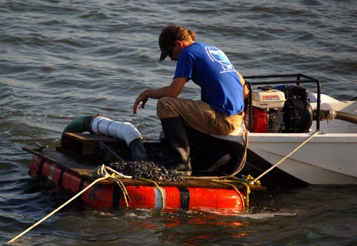
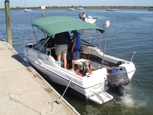
Digging systematic test pits, called “shovel tests,” “shovel test pits,” or “STP’s” for short, is standard practice for archaeologists seeking a site on land. We decided to use the same methodology underwater in Salt Run. Our plan called for the excavation of 20 dredge test pits evenly spaced every 15 meters to cover an area about 60 m by 45 m. To do this, we worked from our smallest boat, the Indy, to deploy divers and a water-pump suction dredge.
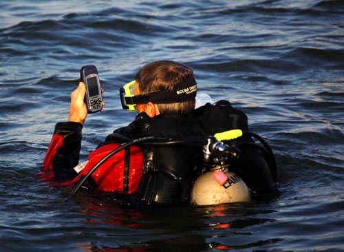
While at the surface, the diver–in this case, Dr. Sam Turner–uses a hand-held GPS to pinpoint the exact location of each dredge test pit.
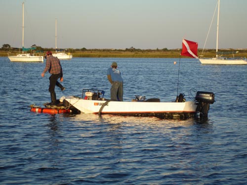
Once on the bottom, the diver uses the dredge to suck up sediment when excavating a test pit. The mud, sand, shell, and anything else is pumped up to the surface where the spoil is sorted through a screen. Any artifacts found in the screen are collected in a labeled bag for laboratory analysis. Here LAMP archaeologist Brendan Burke is on screen duty.
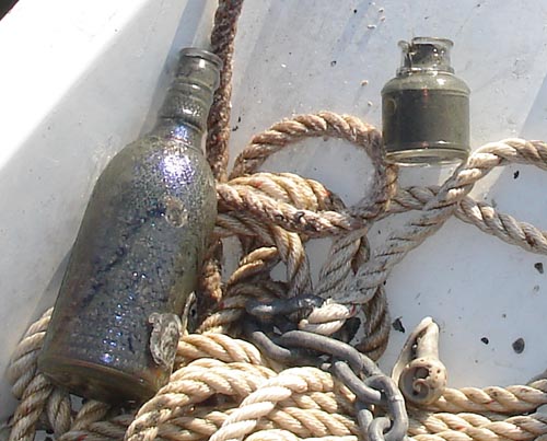
While most of the test holes turn out negative (no artifacts or archaeological material), we do have a few positive hits. What’s more, these are clustered in one zone of our search area (the side closest to the ruins of the original Lighthouse), suggesting we might be on to a buried feature such as a trash pit. The most significant artifacts recovered so far are two intact bottles found in one dredge test pit. They originally appeared to date to the 19th century, but subsequent research on the embossed markings indicate each of the two bottles were manufactured in either 1932 or 1942. This post-dates the original lighthouse, but could coincide nicely with the WWII period of occupation at the light station. One is a pharmaceutical bottle (a laxative, to be specific), the other an ink bottle.
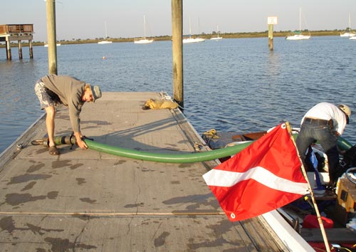
After a hard day’s work, LAMP volunteer Dr. David Huber helps offload the dredge hose and other gear.
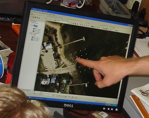
Back in the lab, we use GIS (Geographical Information Science) software to plot out the locations of our test pits on a 2005 aerial photograph.
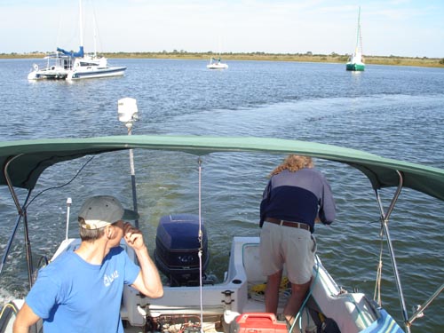
The next phase of the survey includes a remote sensing survey using magnetometer, side-scan sonar, and sub-bottom profiler. Since we were still waiting on our Special Category grand funds to be dispersed, we hadn’t yet been able to order our new side-scan sonar or new magnetometer. We turned instead to an archaeological consulting company called Panamerian Consultants, Inc. Our old friend Dr. Michael Faught works with PanAm, and he came out to help conduct the survey from our mid-sized vessel the Nickerin.
Here Dr. Faught deploys the Marine Magnetics magnetometer off the stern while Sam captains the vessel in this crowded anchorage. The mag sensor head or “fish” needs to be around 50 feet back away from the boat to avoid misreadings from our own engine. The sub-bottom profiler is also deployed off the back of the boat where it sends audible sonar chirps down into the bottom sediments. Unlike the magnetometer, proximity to the engine is not a problem so it hangs just to one side of the vessel.
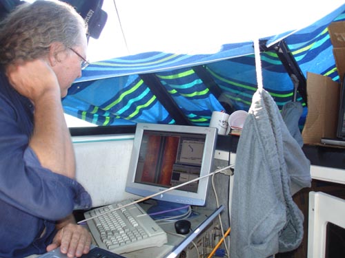
The side-scan sonar is towed from the forwardmost cleat, so that it rides just to one side of the bow. Its signal is fed via cable to a computer on board. Dr. Faught monitors the side scan imagery on the flat screen monitor, along with the sub-bottom output on a laptop computer on his lap. The towels and clothing hanging overhead are to help eliminate glare on the computer screens.
These high-tech toys will generate a lot of data, some of which will take some time to interpret. We already know that we have discovered some new shipwrecks, as we have seen them on the side-scan image–but these appear to be modern sailboats sunk in relatively recent storms. But further analysis may detect more subtle anomalies, which might even turn out to be historic shipwrecks.
In the meanwhile, our state Historic Preservation Special Category grant funds–which will support our First Coast Maritime Archaeology Project–have been issued, and we’ve wasted little time in ordering some of these toys for ourselves. Our new side-scan sonar should be arriving around late December! It will produce images of an even higher resolution than those generated by the unit we have been using here in Salt Run. As we cruise back to the boat ramp, under the comforting gaze of our beautiful Lighthouse, we can’t help but think . . . Great discoveries await!