
On Sunday, we planned to go out to sea with Doug Hrvoic, the owner of Marine Magnetics and manufacturer of magnetometers and magnetic sensors. I was impressed with the Marine Magnetics magnetometer when I first used one back in 2001. Basically, its quality of data was precise, its setup and operation was simple, and it was lightweight and easy to handle. One of my goals when I arrived at LAMP was to acquire a good quality marine magnetometer in order to search the seas around St. Augustine for historic shipwrecks. I was excited, then, when Doug offered to ship us a top-of-the-line marine gradiometer and come show us how to use it during the initial phase of the First Coast Maritime Archaeology Project and Flinders field school practicum.
Plus this Seaquest marine gradiometer has got to be the coolest mag on the market as it looks like a Klingon bird of prey!
A gradiometer is basically a magnetometer with more than one sensor. This allows for a much finer reading of the earth’s magnetic field at any particular spot by measuring the magnetic gradient (rate of change in the magnetic field) and thus enables the discovery of even subtle anomalies, or alterations within the planet’s magnetic field which might be caused by iron or steel objects on the seafloor.
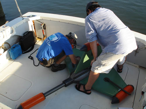
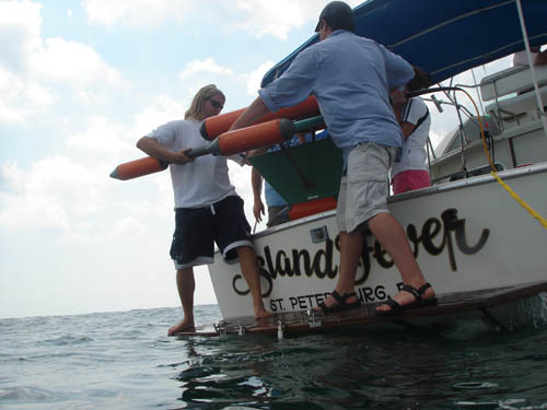
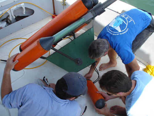
The Seaquest system features four magnetometer heads, mounted on a single towing array. The first step is to assemble this system, which is simple enough to do. Dr. Sam Turner, LAMP’s Director of Archaeology, and visiting professor Dr. Nathan Richards of East Carolina University have no problem doing so on the deck of our research vessel, the Island Fever, while field school student Deanna Sundling stands by to lend assistance.
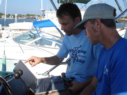
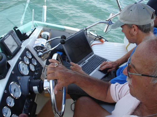
Doug shows Sam the software that runs the magnetometer. Doug has taken time away from his family vacation to train us on how to use this mag, along with a terrestrial walking magnetometer provided by his father’s company GEM Systems. This is an utterly generous act, as the equipment Doug shipped us for free is valued at more than $100,000, and of course time with his wife Melissa and daughter Victoria is even more valuable. Nonetheless, he has given us several early mornings, a classroom lecture on the theory of magnetic detection, a workshop on the land mag, and now a morning at sea to get us started on this particular unit, which is more sophisticated than any magnetometer than any of us have ever used.
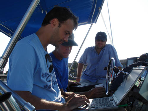
The computer side of things is just as vital as the sensor head. We are running Marine Magnetics software as well as a navigational survey software. This way we can use the computer, which is hooked up to a GPS, to help the boat captain stay on particular track lines of a pre-determined survey area.
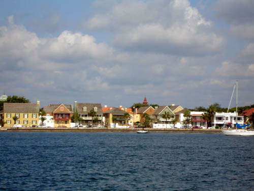
Once the software and computers are successfully deployed, we head out to sea to conduct some actual survey lanes. As we pass the bayfront section of downtown St. Augustine, I can’t help but compare its colorful architecture to that seen along various island harbors throughout the Caribbean.
We proceed out the inlet to the sea, and make our way to a survey area just north of the inlet. This is near a dredging area defined by the U.S. Army Corps of Engineers for beach replenishment. During recent beach renourishment dredging, at least one historic shipwreck was impacted, as indicated by the numerous artifacts that were dredged ashore. The Army Corps and its contracted specialists have been unable to located this mystery wreck so far. We are continuing the search in an area outside the confines of this dredging area, which might contain part of the shipwreck in question.
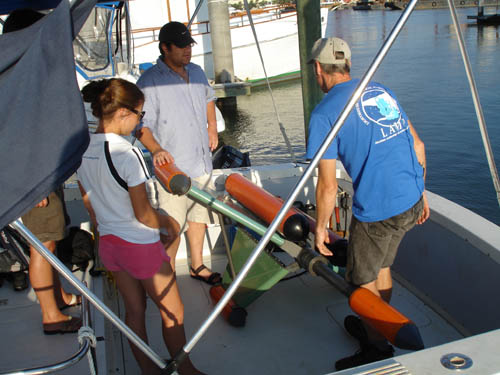
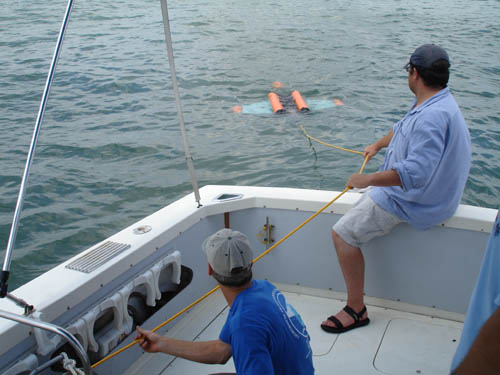
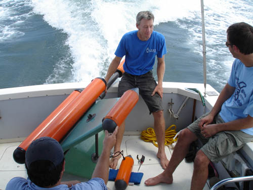
The one disadvantage of this highly sophisticated mag is that it is much larger than a simple marine magnetometer, and more unwieldy. It takes four of us to manhandle it over the transom and into the waiting sea.
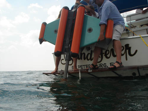
Sam handles the reel of cable, while Nathan carefully pays out cable to the “fish” or sensor array which floats on the surface behind the boat.
With the fish safely behind the boat, the survey begins, and it descends into the water column when towed behind the Island Fever at a moderate speed. Readings from the mag are sent via its tow cable to the survey laptop at the helm. This laptop is recording four independent streams of data from the mag, while at the same time providing navigational information to the captain.
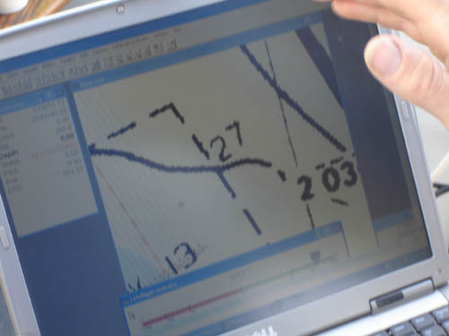
This close-up of the computer screen shows the survey lanes (left side of screen) as set up overlaid on a nautical chart. Our boat captain, volunteer Dick Orsini, can see the real-time position of the boat on this map, and can use this to help travel in a straight line.
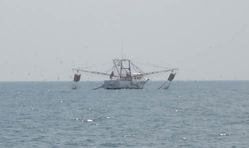
On the horizon we watch shrimp boats dragging their nets. This region was the birthplace of the shrimping industry in the early decades of the 20th century. Wooden-hulled shrimping vessels were built here as late as the early 1980s, and some boats like the one pictured still operate this traditional and challenging livelihood in local waters.
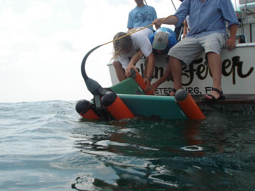
Trouble comes, as it does to those attempting archaeology at sea. Our survey area is too shallow to drag this magnetometer in this particular configuration (it can be altered to better work in shallow waters). In only 8 feet of water we run the mag aground. The problem is immediately apparent, and we bring in the fish for inspection.
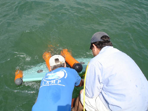
We immediately notice that one of the sensors has broken away from the towing frame. Judging by its output on the computer, it appears to still be functioning. But in order to continue survey, it must be reattached to the towing assembly. This is as simple as replacing the screws which sheered and broke under the stress. Amazingly, the rest of the equipment has fared well, despite being run aground while underway. Doug assures us that Marine Magnetics engineers all of their equipment to be virtually bulletproof. Incidents such as this are standard when operating at sea, and the fact that this equipment can be redeployed once a few screws are located is a testament to its rugged durability.
As it turns out, we needed to return Doug to his family by mid-day anyway, and since this was a training exercise we consider it successful despite temporarily disabling the toy. Doug will be letting us use this machine after he leaves, and this experience has taught us that 1. the equipment is extremely durable, but care must still be taken, and 2. In shallow areas such as this, the Marine Magnetics mini-magnetomter (one single sensor) is the best tool for the job. This is the model that we are interested in purchasing.
As we return through the inlet to Matanzas Bay in front of downtown, we are witness to a once-common but now unique sight–the schooner Freedom unfurling its sails. I caught the maneuver on video, which is included below.
All in all, a good day at sea, despite our problems. With Doug’s help, we have successfully set up and run the mag for several survey lanes and we have gotten the software programs to coordinate output from the GPS with data from the mag. We will now be able to conduct this survey ourselves, and we will take advantage of the system on loan to us to get as much survey work completed as possible. In addition to the northern area we worked today, we are keen on locating the remains of the Confederate privateer Jefferson Davis, which wrecked on the shoals north of the 19th century channel, which is south of the present day inlet. For now we will keep our eyes on the prize and keep searching beneath the waves of America’s oldest port.