I have now been staying in Victor Harbor with the Flinders University maritime archaeology field school for seven days. I thought I’d share a little bit of the history of this fantastic place. First I’ll set the stage by showing you exactly where we are.
Here is a map of Australia showing the location of the state of South Australia:
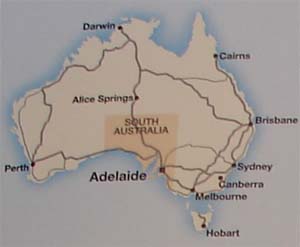
All of the major cities are shown, including the capital of South Australia, Adelaide. This bustling city is also the location of Flinders University (or “Uni,†as the locals call it).
South of Adelaide is the Fleurieu Peninsula. We will be based at Victor Harbor, on the southeast coast of the peninsula, but will be working at various locations throughout the peninsula, as seen below:
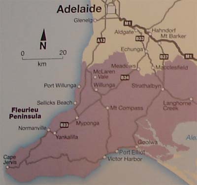
The Star of Greece wreck, which I have been diving on, is located at Port Willunga on the upper western coast of the peninsula. Port Elliot, the first port in the region, is located to the east of Victor Harbor. Beyond it is Goolwa, at the mouth of the Murray River. Next to it is Hindmarsh Island (not shown on the map), the site of two more shipwrecks and pier remains exposed on the mud flats, all of which are being investigated by the field school. The three student teams will mainly be working at Victor Harbor (historic baths and causeway), Goolwa/Hindmarsh Island (Showboat wreck, Grappler wreck, and pier/jetty remains), and Port Willunga (Star of Greece wreck, fishermen’s caves, and pier/jetty remains).
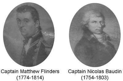
The Fleurieu Peninsula juts out intoEncounter Bay. This bay was named after the chance meeting on 8 April 1802of two explorers, Englishman Mathew Flinders sailing in Investigator and Frenchman Nicolas Baudin in Geographe. Both were exploring and charting the coast of South Austrailia for their countries. Despite the fact that France and England were at war, the two met and exchanged notes.
For the next 30 years or so, there were relatively few visitors to the Bay other than the occasional sealers or whalers seeking their prey. Whaling was one of Australia’s first industries, starting in Sydney as early as the 1790s. By the turn of the century, sealers had joined Australia’s whalers, exporting sealskins and seal oil in addition to whale oil. These entrepreneurs were the first Europeans to encounter the Ramindjeri Aboriginal peoples.
In 1837, the South Australian Whaling Company established a whaling station at Victor Harbor. That same year tragedy struck twice when the whaling vessels Solway and South Australian wrecked in storms. Three whaling stations in the region would operate until 1855.
By the middle of the century, the nearby Murray River was opened for trade, and the town of Port Elliot was established in 1852 to facilitate the export of agricultural and pastoral goods coming downriver.
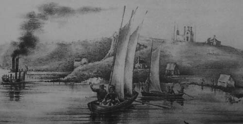
This 1854 drawing of Goolwa shows both steam and sail traffic at the mouth of the Murray River.
The first public railroad on the Australian mainland was built to connect Goolwa at the mouth of the Murray River (which was unsuitable for a port) with Port Elliot in 1854. Two steamers, Lady Augusta and Mary Ann, plied the river at this time; within four years there were 15 steamboats in operation.
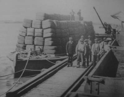
Wool awaiting unloading at the Goolwa wharf. Railroad tracks (visible on the wharf in this picture) were constructed from Goolwa to Port Elliot, and later to Victor Harbor, to facilitate exports of goods from the hinterland shipped down the Murray River.
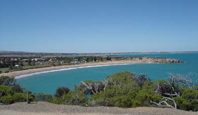
Horseshoe Bay at Port Elliot, the first port established to handle the export trade from the nearby Murray River. This area proved unsuitable for a port, and a number of shipwrecks lie beneath these waters.
An increasing number of coastal traders called at Port Elliot, peaking in 1856 when a total of 79 ships entered the bay. Despite this, it became apparent that this was not the most suitable location for a seaport, as its position left ships exposed to heavy winds and seas. Efforts to mitigate these problems were made by constructing a jetty and breakwater, and setting permanent moorings.
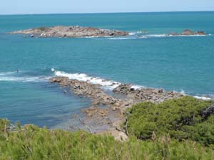
Remains of the breakwater built at Port Elliot in a vain attempt to improve the safety of the harbor. Construction of this breakwater began in 1852 and was abandoned in 1856 after severe storms.
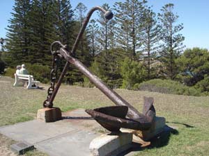
Anchors such as this one were used to set up permanent moorings in Port Elliot’s harbor.
But Port Elliot’s reputation was irrevocably tarnished when, within twelve years of operation, a total of seven ships were lost in its harbor. In 1864 a railway extension was opened to Victor Harbor, which rapidly became the main port of call for the region.
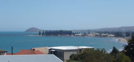
Victor Harbor as seen today. At the left is Granite Island, connected to the mainland by a causeway.
There are a number of possible activities related to these historic events that may be incorporated into the Flinders University field school. Remote sensing surveys can be carried out to search for the early whalers Solway and South Australian. A land magnetometer survey is being carried out on Middleton Beach in an attempt to locate the 1853 wreck of the Emu, which is believed to lie under the sand dunes. Diver investigations are taking place on the jetty and baths at Victor Harbor, and (as we saw from my earlier post) on the wreck of the iron-hulled ship Star of Greece, lost in 1888 at Port Willunga to the north of Victor Harbor. Two days ago we visited an early 20th century salvage camp associated with the wreck of the MV Victoria (I may post some pictures from that field trip, but I’ll have to get them from other folks since I forgot my camera). Like my home of St. Augustine, this area has a rich maritime history and a dynamic maritime landscape, and there is no shortage of archaeological sites to explore.
For all of those out there who have been enjoying my blogging from Down Under, I’d like to share another blog being written by the students working on this field school. The Museum of Underwater Archaeology is sponsoring an official Flinders University field school project journal at
http://www.uri.edu/mua/
The Museum of Underwater Archaeology is also one of LAMP’s partners. They are currently hosting an online exhibit of the Industry, a British sloop wrecked off St. Augustine in 1764 and excavated by LAMP archaeologists. The St. Augustine Lighthouse and Museum hosts an exhibit of the artifacts recovered from this wreck, but the virtual exhibit at MUA is well worth a browse.
G’day from Down Under!

